


THE HISTORY
Associated with the Incan Empire, or more correctly Tahuantinsuyo, Choquequirao is dated as a 15th & 16th-century Inca settlement.
The site had two notable stages of development; the first it was founded by Pachacuti and secondly his son, Tupac Inca Yupanqui, remodeled and extended it after becoming the Sapa Inca.
Choquequirao is located in the area considered to be Pachacuti’s estate; which includes the areas around
the rivers Amaybamba, Urubamba, Vilcabamba, Victos and Apurímac.
There are a number of other sites in this area namely Machu Picchu, Chachabamba, Guamanmarca etc.; and they all share a likeness in style with Choquequirao.
The architectural style of several important features appears to be of the Chachapoya design framework, suggesting that Chachapoya workers were probably
involved in the construction. This indicates that Tupaq Inka probably ordered the construction. Old colonial documents also would indicate that Tupac Inka ruled Choquequirao since his great grandson, Tupa Sayri, took ownership of the site and neighboring lands during the Spanish colonization period.
It is widely regarded as one of the last mainstays of resistance and refuge haven of the Son of the Sun (the “Inca”), Manco Inca Yupanqui, who fled Cusco after his attempted siege of the city in 1535.

THE SECTORS
Choquequirao is situated at an elevation of 3,000 m above sea level on a southwest-facing spur of a glaciated peak above the Apurimac River. The region is characterized by mountain topography and covered with Amazonian flora and fauna. It is 98 km west of Cusco, in the Vilcabamba range.
The complex covers 6 km2. The main structures, such as temples, huacas, elite residences, and fountain/bath systems are concentrated around two plazas along the crest of the ridge, which encompass approximately 2 km2 and follow Inca urban design.
Also there is a conglomeration of common buildings clustered away from the plaza. Excavations and surface items suggest they were probably used for workshops and food preparation. Most buildings are well-preserved and well-restored; restoration is ongoing.
The terrain around the site was greatly modified. The central area of the site was leveled artificially and the surrounding hillsides were terraced to allow cultivation and small residential areas. The typical Inca terraces form the largest constructions on site.
Many of the ceremonial structures are associated with water. There are two unusual temple wak’a sites that lie several hundred meters lower than the two plazas. These are carefully crafted step terraces down a steep slope are designed around water.
The site also contains a number of ceremonial structures such as the large usnu built on a truncated hill, the Giant Staircase, and an aqueduct providing water to the water shrines.
Ceremonial Center
The ceremonial center of Choquequirao has features similar to those of other Inca ceremonial centers and pilgrimage sites, such as Isla del Sol, Quespiwanka (Qhispi Wank’a, palace of Huayna Capac), Machu Picchu, Llaqtapata, Tipon, and Saywite.
Comprising the main platform and a lower plaza; stone-lined channels carried ceremonial water, or chicha to shrines and baths throughout the site. The main platform, unique in its size and prominence, was constrained to ceremonial activity for the royal and the ministerial classes. Other notable features of the ceremonial center include structures that mark the direction of certain solar events, such as when the June and December Solstice sun rises and sets.
Located on the main platform, the Giant Stairway opens to the sunrise of the December solstice. Measured at 25 meters long and 4.4 meters wide, this structure seems to have been purely ceremonial in function, since the stairs end abruptly partway down a hill, leading to nothing. Large boulders that rest upon the risers of the stairway become fully illuminated when the December solstice sun rises.
In the lower plaza, a group of structures was found that appeared to be water shrines and baths. This belief is held based on their strong resemblance to those at sector II of Llaqtapata and because there are numerous water channels leading to that portion of the plaza.
Overall, it seems as though the site was chosen, in the same way as Machu Picchu, for its sacred geographical location, and was designed to facilitate ritual and ceremonial activity.
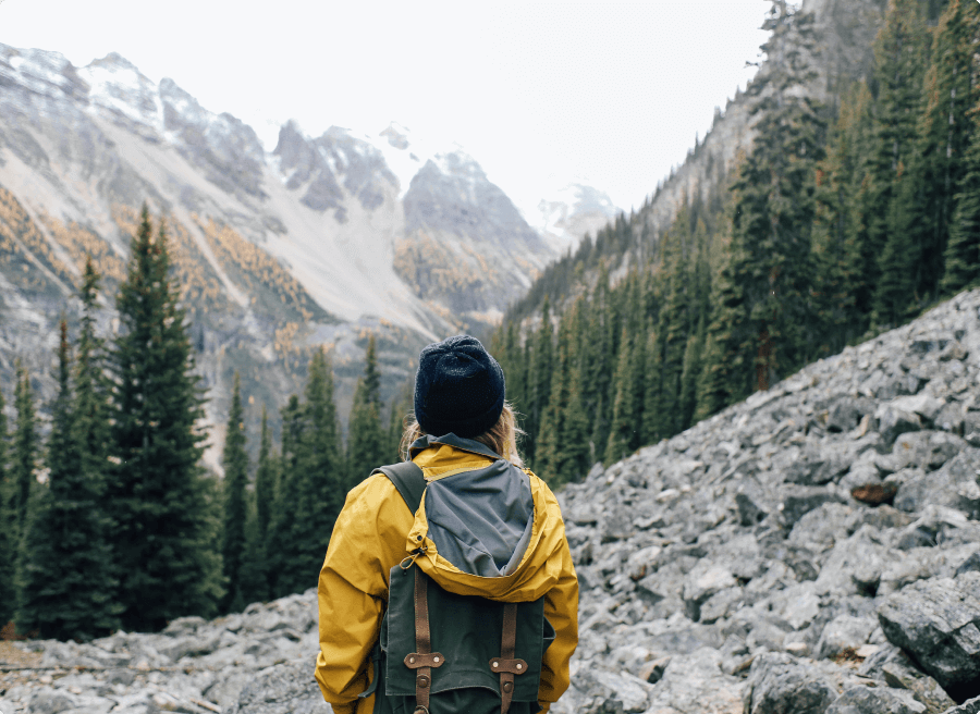
ROUTES INTO THE CITADEL
Routes to Choquequirao
Often hard and dusty trails, it’s best to set off on each day at the crack of dawn, if not earlier. This allows you to trek in the shade and relative cool of the early morning climates. Once the sun beats down, depending on which part of the trail you are on; the heat can be unforgiving and you’ll find yourself reaching for your backpack more often than you’d like.
To make the most of this trek we recommend allowing yourself 5 days minimum.
The first day is a long descent down to the Rio Blanco, we would recommend camping here and allowing yourself a full day on the second day to reach the Choquequirao citadel. Then you have a full day on day 3 to explore the entire area and ruins at your own leisure.
There are two options at this point, depending on how your trek is set up; you can either head to Huanipaca for your way out and back to Cusco or you trace back the way you trekked in.
However, you decide to do this trek; you’ll remember it for a very long time for its sheer beauty and breathtaking landscapes but also for the incredible people you meet along the way for whom the valley is a way of life.
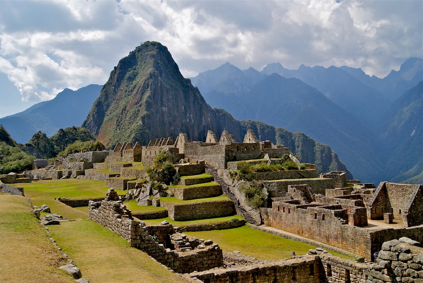
Machupicchu
THE HISTORY
Machu Picchu is a 15th century Inca citadel located on a ridge between the Huayna Picchu and Machu Picchu mountains in Peru. It is located 2,430 meters above sea level, on the eastern slope of the Andes, and overlooks the Urubamba River hundreds of meters below.
The excellent preservation of this site, the quality of its architecture and the impressive mountain scenery it occupies have made Machu Picchu one of the most famous archaeological sites in the world. It has also recently been incorporated as one of the seven wonders of the world.
The site occupies 32,500 hectares. The terraced fields on the edge of the site were once used to grow crops, probably corn and potatoes.
There are different trains you can take to get to Machu Picchu: the Expedition train or the Vistadome, and also the Hiram Bingham, for a more luxurious trip. All trains depart from the outskirts of Cusco, from the Poroy station, or you can travel to Aguas Calientes from Ollantaytambo. As well as exploring the interior of Machu Picchu it usually takes a full day, so we recommend that you prepare yourself with tickets before you arrive to make the most of the day there.
You can explore the site at your own pace, usually around 4 hours is enough time to really understand the site. If you arrive late in the morning, around 11, you will miss the crowds. It’s basically a much quieter and more leisurely hour. In our opinion, it is the best time to explore.